The Routing OSM API method calculateReachableAreas calculates the areas which can be reached from a waypoint within given horizons.
For this calculation, the PTV Routing OSM API considers the road network distance.
Use Cases
The synchronous method calculateReachableAreas or the asynchronous method startAndCreateReachableAreas is designed for isolines calculation. Isolines describe zones based on driving distance or travel time horizons. The polygons returned describe specifically this kind of zones. These polygons can be used for a geofencing use case. The geofencing defines virtual geographical barriers around a geographical position.
Detailed Consideration
Calculate reachable areas
These are the input parameters for the calculation of the reachable areas:
- waypoint
The Routing OSM API triggers a search around the geographical coordinates contained in the waypoint. - profile
This parameter sets the profile to be used to calculate the reachable areas. - horizons
Horizons give the Routing OSM API the distances or times which should be used to calculate the areas. - horizonType
This determines whether the calculation should be time ('TRAVEL_TIME') or distance ('DISTANCE') based, dependent on the horizonType. - options
These are routing-relevant options like drivingDirection.
Reachable areas
The returned polygons are the reachable areas for each horizon. Multiples horizons can be requested and received in the same response.
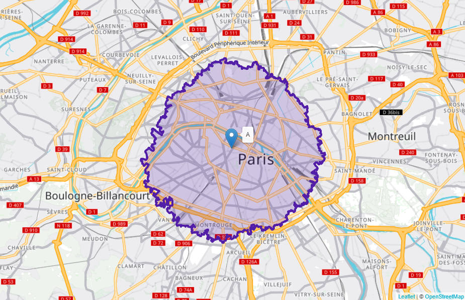
Visualization of a reachable areas response with a horizon of 5 kilometers around a waypoint
Limitations
- Synchronous reachable areas calculation is limited to 25 kilometers or 20 minutes horizons depending on the horizon type.
- Asynchronous reachable areas calculation is limited to 100 kilometers or 60 minutes horizons depending on the horizon type.
- The number of horizons is limited to 5.
Try it in the Calculate Reachable Areas Synchronously code sample or the Reachable Areas showcase.