The Raster Maps service draws the map content separately layer by layer. Therefore it is possible to request several data layers separately or to combine them in the following order:
| background - the background areas such as forests, building areas or oceans |  |
| transport - the transportation network with all types of roads | 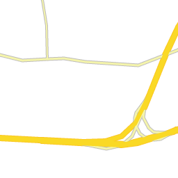 |
| labels - the labeling of the map showing city names, road names as well as road signs | 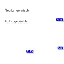 |
Beside these base layers there are further use case dependent layers:
trafficIncidents
| trafficIncidents - a snapshot of the current traffic situation, showing for example traffic jams and road blockings | 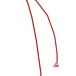 |
| Stroke colour | Meaning |
|---|---|
| #000000 (Black) | Road affected, speed unknown / fully blocked |
| #660000 (Dark red) | Very low speed through the incident |
| #990000 (Red) | Reduced speed through the incident |
| Icon | Meaning |
|---|---|
 | Traffic jam / queue |
 | Delay |
 | Delay (truck) |
 | Road blocked |
 | Junction closed |
 | Road blocked for trucks |
 | Lane closed |
 | Obstruction on the road |
 | Vehicle fire |
 | Accident |
 | General danger / hazard |
 | Railroad crossing |
 | Traffic lights defective |
 | Ice on the road |
 | Snow |
 | Fog |
 | Rain |
 | Strong wind |
 | General adverse weather |
 | Roadworks / construction |
 | Weather forecast warning |
trafficPatterns
| Usual travel speed on roads at the requested time and day of the week | 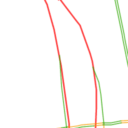 |
| Color | Meaning |
|---|---|
| #FF0000 (Red) | Heavy / stop-and-go |
| #F7A20E (Orange) | Dense / slow traffic |
| #38AA0E (Green) | Free flow |
restrictions
| Restricted transit areas, truck routes and vehicle specific restrictions | 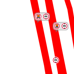 |
| Color | Meaning |
|---|---|
| #FF0000 (Red) | Restricted Segments |
| #154889 (Blue) | Preferred Route |
| #704A4B (Brown) | Restricted transit area |
| #2e1f1f (Very dark brown) | Extended restricted transit area |
| Icon | Meaning |
|---|---|
 | Generic truck restriction (fallback) |
 | Residential road (avoid through-traffic) |
 | Several truck restrictions clustered at one spot |
 | Road blocked for trucks |
 | Blocked for trucks, delivery traffic allowed |
 | Open for delivery traffic |
 | Combustible / explosive goods prohibited |
 | Trailer-related restriction |
 | Hazardous goods prohibited |
 | Goods hazardous to water prohibited |
 | Maximum axle load / axle-count restriction |
 | Maximum height restriction |
 | Maximum length restriction |
 | Maximum weight restriction |
 | Maximum width restriction |
     | ADR hazardous-goods tunnel category |
toll
| Roads on which tolls are charged for specific vehicle types | 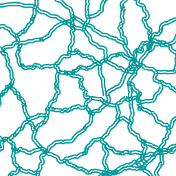 |
| Color | Meaning |
|---|---|
| #009999 (Teal) | Toll applies on this road |
lowEmissionZones
| Zones where the most polluting vehicles are forbidden from routing |  |
| Color | Meaning |
| #00A486(Green-teal, 35% opacity) | Environmental zones |
Time Dependency
Restrictions, traffic incidents, traffic patterns and toll contain time dependent data. If no reference time is specified the current UTC time is used. Vehicle specific restrictions that are not valid at the given point of time are drawn in gray.
Vehicle Dependency
Restrictions, traffic patterns contain vehicle dependent data. If no vehicle type is specified, TRUCK is assumed as default.